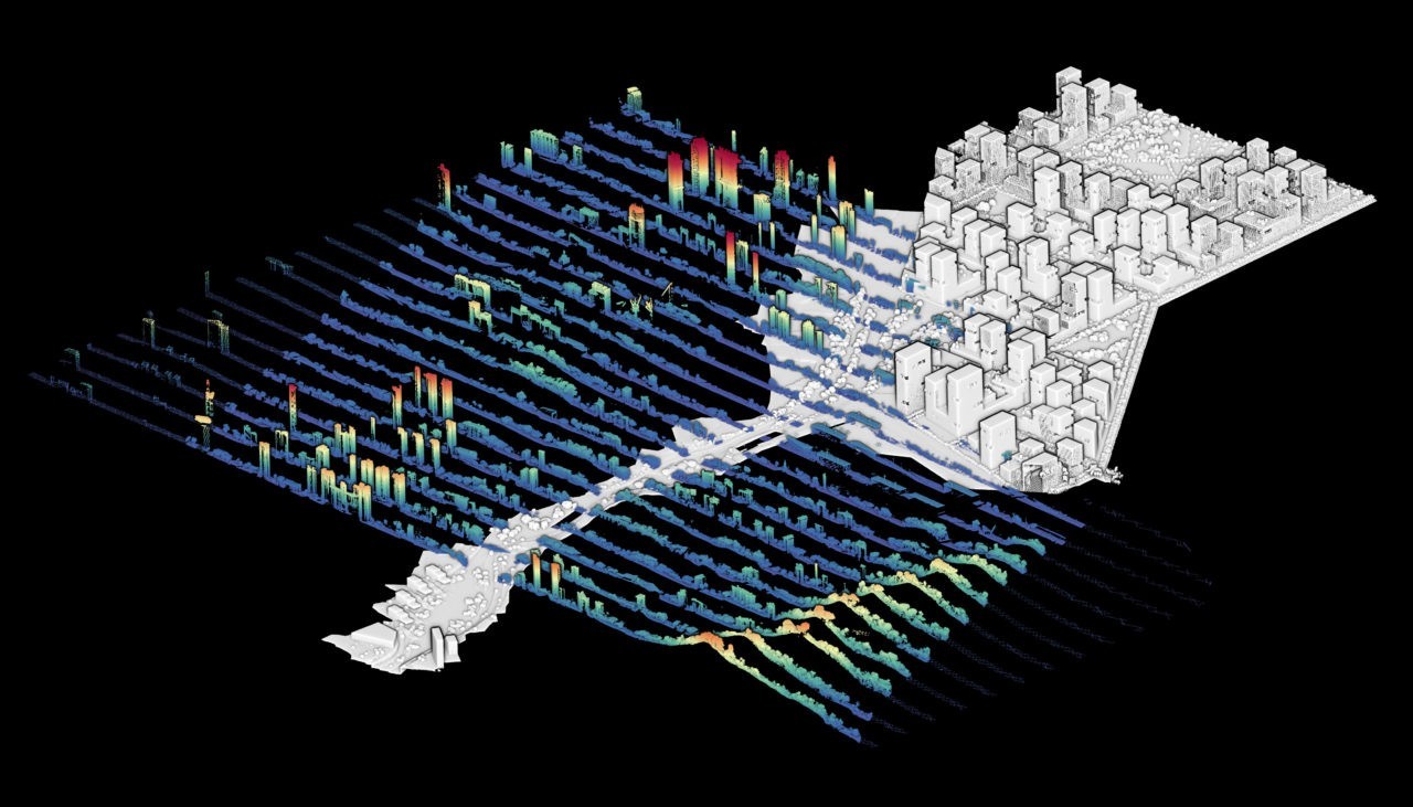
A new approach in landscape design uses point cloud modeling to integrate spatial, aesthetic and quantitative features of the landscape. The method is applicable in any location and thus makes it useful to a wide range of topics, whether in the context of cultural, agricultural or urban landscapes, with design challenges about rising water levels, flooding, forest fires, noise and air pollution, and urban heat island.
In the 1990s, laser scanning technology was increasingly used to collect spatial data for landscape planning and management. In more recent applications, laser-scanned datasets are edited as models and visualized in 3D space. The resulting point cloud models have been used to position designs in a scanned context. Beyond their function of representation, point cloud models can be manipulated to simulate landscape change. Using editing techniques developed in the Landscape Modeling and Visualization Laboratory at ETH Zurich, point cloud models can be used to support analysis and design development specific to a site.
This new method for landscape design takes place entirely in a georeferenced 3D space and consists of rearranging parts of a laser scanned model to develop new spatial configurations. The method requires a preparatory phase of terrestrial or aerial laser scanning survey with modeling tasks to build a point cloud model of an existing site from which to start the design process. This model is used in its three-dimensional form for site analysis to reveal landscape features relevant to the project, such as the form of the terrain and the appearance and density of the vegetation. The model is then used as a source to perform three steps that support design tasks. First, the source model is disassembled into pieces using classification, segmentation, and filtering tools. This makes it possible to separate the terrain from the land cover and to segment further to edit entities separately. Then, the separated entities of the source model are used for a variety of modeling purposes that enable to manipulate the topography and the land cover.
Design Proposals by Blending the Analogue Landscape with the Digital Model
The manipulation allows a precise and progressive transformation of the spatial configurations of the natural and built environment. It thus makes it possible to precisely integrate a design project in a pre-existing context. In the third step, the parts are reassembled to form again a complete point cloud model that contains the design proposal. In this step, the polygons representing the topography and the built environment are converted into synthetic points and are merged with the modified parts that stem from laser scans. Finally, using the geo-reference of the scanned parts, the modified model is reassembled with the unchanged context. The reassembled model incorporates measures necessary to quantify the design in terms of, for example, leaf area density to calculate its capacity for carbon storage and of radiative transfer to analyze the impact of vegetation in the urban environment.
The importance of the method as a tool for imagining and shaping new spaces is tangible and has the potential to mix digital techniques with analog studies for the development of future landscaping solutions. This design method has the advantage of integrating spatial, aesthetic and quantitative features of the landscape and of being applicable in any location. This makes the method useful for a wide range of topics, whether in a context of cultural, agricultural or urban landscapes, with design challenges about rising water levels, flooding, forest fires, noise and air pollution, and urban heat island.
The methods presented in this article are part of the doctoral thesis developed by Philipp RW Urech at the Future Cities Laboratory in Singapore, affiliated to the Chair of Professor Christophe Girot. This article stems from the peer-reviewed paper «Point-Cloud Modeling: Exploring a Site-Specific Approach for Landscape Design» by the same author (2019), Journal of Digital Landscape Architecture, 290–297.