Swiss Programme for Research on Global Issues for Development (r4d Programme)
Introduction
MANAGING TELECOUPLED LANDSCAPES aims at exploring concrete pathways for sustainable livelihoods in forest frontier landscapes and explores how transdisciplinary learning among multiple stakeholders opens up pathways to adaptive governance of telecoupled social-ecological systems.
Motivation
The debate about Sustainable Development Goals following the United Nations “Rio+20” reveals the difficulty of simultaneously addressing social and economic development challenges as well as the degradation of Earth’s life support systems. Land systems in the humid tropics illustrate these challenges prominently. Local people’s land use strategies face competition from large-scale land acquisition, logging etc., but also from biodiversity conservation. Remote decision-makers reshape flows of ecosystem services to their benefit, whereas the consequences hardly reach them. In this context, MANAGING TELECOUPLED LANDSCAPES explores the impacts, positive and negative, of these distant drivers on local socio-ecological systems and strives to identify strategies that would enable local actors to secure their well-being sustainably.
Goal
The overall goal of the project is to develop and test innovative strategies and institutional arrangements for securing ecosystem service flows and human well-being in and between telecoupled landscapes at study sites in Laos, Myanmar, and Madagascar.
Approach
Research activities take place in three Work Packages (WP). These WP are implemented in the three study countries Laos, Madagascar, and Myanmar with the aim to obtain comparable results.
The first work package led by the University of Bern will analyse how telecoupling influences decisions on land use, and how these in turn modify the flows of ecosystem services and their impact on human well-being. For this purpose, we will identify the actors involved and study their relational patterns by means of social network analysis (SNA).
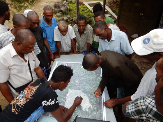
The second work package, which is led by ETHZ-IRL-PLUS, seeks to model land use decisions and resulting land use dynamics in the case study areas. To that end, we will develop Bayesian network-based land-use decision models to explain past land use change, predict future changes, and facilitate learning processes. The models will be parameterized through participatory stakeholder interaction and result in mapped land-use change scenarios.
The third work package, led by the University of Antananarivo, will translate insights of WP1 and WP2 into concrete innovations using a structured multi-stakeholder learning processboth measuring and fostering learning between stakeholders.


