Digital technologies have become ubiquitous in current design practice for urban landscapes. Not only does the rapidly increasing extent and resolution of digital data help to study urban systems, but digital technologies have also enabled the inclusion of dynamic conditions in the design process. Understanding these conditions makes it possible to design shapes that respond to the characteristics of a site.
The morphology of cities is subject to a diachronic and cumulative evolution that gradually transforms the urban environment. This evolution causes a reciprocal dependence between the form and formation of the environment, in which the shape affects dynamic conditions, and dynamic conditions influence the shape. Dynamic conditions of the environment such as water flow, climate, weather patterns, vegetation growth, and anthropogenic activities call for digital techniques to design forms that continue to function as intended under changing circumstances.
Scientific Feedback
Design practice and theory increasingly rely on digital technologies to study urban landscapes on varying time scales. The notion of “digital twin” has emerged to describe the simulation of physical assets for testing designs at high and low frequencies. In the field of landscape design, a similar shift towards a discourse on design performance with scientific feedback. The integration of performance in the design process is achieved through two main components: digital modelling, to study the physical form of the design, and dynamic simulation, to study the time-varying behaviour of dynamic systems based on scientific data.
Together, digital modelling and dynamic simulations can shape spatial configurations that perform in responsive ways to the site. Current design methods employ digitally reconstructed models with indicative dimensions that limit the interaction with the actual landscape form. However, point cloud models measured with laser-scanning technology instead allow the entire physical structure of a site to be geometrically represented, visualized and evaluated at various scales. The digital modelling of the measured points helps to explore accurate spatial and aesthetic compositions in landscape design.
Designing with Evidence
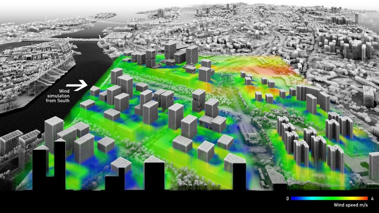
The point cloud modelling method was used to study visions along the Rail Corridor in Singapore (see figure). The design of orchestrated configurations of spaces, vegetation and buildings can improve airflow in the prevailing wind direction. By iterating digital modelling and dynamic simulation, the design process evolves towards solutions that best enhance thermal comfort at the street level. This method can bring together creative ideas with ecosystems to create diverse urban landscapes based on defensible scientific evidence.
The choice of the simulation depends on the site and affects many design decisions; for example, how light and shadows interact with architecture, movement reacts to spatial configurations or water management impacts flood-prone settlements. Landscape architects and planners are required to justify proposals for their visual effect and the contribution they make to the performance of a specific environment. Including traits of the landscape and forecasting the impact of change has therefore become a primary requisite for developing design scenarios.
The design methods presented in this article are described in the doctoral thesis «Shaping Physical Landscape» by Dr. Philipp RW Urech. The research was conducted at the Future Cities Laboratory in Singapore, under the supervision of Prof. Christophe Girot, Prof. Adrienne Grêt-Regamey and Prof. Bradley Cantrell.
https://vimeo.com/519904125

